 1851 - 1936 (84 years) 1851 - 1936 (84 years)
-
| Name |
John Fleming Payne |
| Born |
3 May 1851 |
Warren County, Indiana  |
| Gender |
Male |
| Died |
24 Jan 1936 |
Enid, Garfield County, Oklahoma  |
| Buried |
Rose Hill Cemetery, Carriar, Garfield County, Oklahoma  |
| Person ID |
I10279 |
Treespot |
| Last Modified |
29 Apr 2019 |
| Father |
James W. Payne, b. 17 Sep 1823, Fayette County, Kentucky  , d. 26 Sep 1889, Caldwell, Sumner County, Kansas , d. 26 Sep 1889, Caldwell, Sumner County, Kansas  (Age 66 years) (Age 66 years) |
| Mother |
Sarah Elizabeth Wagoner, b. 19 Jan 1826, Ohio  , d. 6 Jun 1891, Caldwell, Kansas , d. 6 Jun 1891, Caldwell, Kansas  (Age 65 years) (Age 65 years) |
| Married |
7 Sep 1845 |
Warren County, Indiana  |
| Family ID |
F806 |
Group Sheet | Family Chart |
| Family |
F.E. Duncan |
| Children |
| | 1. Charles William Payne, b. 14 Sep 1884, Caldwell, Sumner County, Kansas  , d. 9 Dec 1964, Enid, Garfield County, Oklahoma , d. 9 Dec 1964, Enid, Garfield County, Oklahoma  (Age 80 years) (Age 80 years) |
| | 2. Sarah "Sadie" Elizabeth Payne, b. 1888, d. 1955 (Age 67 years) |
| | 3. George Henry Payne, b. 11 Apr 1890, Caldwell, Sumner County, Kansas  , d. 17 Feb 1964, Carrier, Garfield County, Oklahoma , d. 17 Feb 1964, Carrier, Garfield County, Oklahoma  (Age 73 years) (Age 73 years) |
| | 4. John Howard Payne, b. 1892, d. 1892 (Age 0 years) |
|
| Last Modified |
29 Apr 2019 |
| Family ID |
F3949 |
Group Sheet | Family Chart |
-
| Photos
|
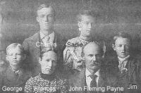 | John Payne Family
Found at: https://www.findagrave.com/memorial/15553375/john-fleming-payne |
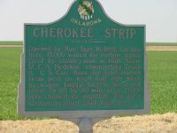 | John F. Payne "made the run into the Cherokee Strip and settled northwest of Enid," Oklahoma on 16 September 1893.
According to his obituary found on findagrave.com
Sign says, "Opened by run, Sept. 16, 1893. On line here, 15,000 waited for carbine signal fired by cavalry man at High Noon. Lt. C.A. Hedekin commanding Troop A, U.S. Cav. Race for land started from post on knoll half mile west, by wagon, buggy, bicycle, horse and train. In 60 by 90 mile area, every acre claimed by nightfall. The first settlers reached Enid from here." |
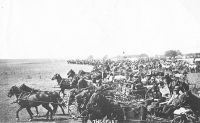 | John F. Payne, brother of Jennie Payne Fansler "made the run into the Cherokee Strip and settled northwest of Enid, Oklahoma."
|
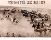 | John F. Payne "made the run into the Cherokee Strip and settled northwest of Enid," Oklahoma.
|
| Archives
|
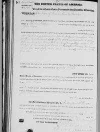 | 1880 March 13 Land Patent, Kansas, Sumner County,
John Payne's land patent cert #9796 under President Rutherford B. Hayes
lots 3 and 4 and the south half of NW quarter of section 4 in Township 34 south of range 3 West. 157 acres.
Found at:
https://glorecords.blm.gov/details/patent/default.aspx?accession=KS3760__.146&docClass=STA&sid=rtyb5r2y.lii#patentDetailsTabIndex=1 |
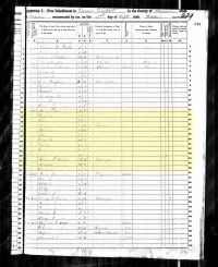 | 1885 Kansas State Census Record Sumner County, Caldwell
Head of Household - John Payne, age 34, white, male, married, farmer
Wife - Frances Payne, age 31, white, female, married
Son - Charles Payne, age 7 months, white, male, single |
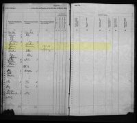 | 1885 Kansas State Census Record Sumner County, Caldwell
John Payne born in Indiana, came from Indiana to Kansas
Wife, born in Minnesota, came from Minnesota to Kansas
Son, born in Kansas, Kansas native |
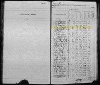 | 1885 Kansas State Census Record Sumner County, Caldwell
John Payne, occupant of farm on 1 March 1885
20 acres fenced
88 acres not fenced
108 acres total
$2,000 value of farm
$200 value of farm implements |
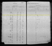 | 1885 Kansas State Census Record Sumner County, Caldwell
John Payne's Agriculture on his farm:
150 rods of wire
15 acres of winter wheat sown in 1884
25 acres of corn to be sown in spring 1885
8 acres of oats to be sown in spring 1885
1/2 acres of Irish potatoes to be sown in spring 1885
4 acres of millet to be sown in spring 1885
100 bushels of corn on hand
|
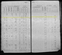 | 1885 Kansas State Census Record Sumner County, Caldwell
John Payne's farm's agriculture and livestock:
5 tons tame cut hay in 1884
10 tons prairie cut hay in 1884
2 mules
1 milch cow (kept for milk)
1 other cattle
32 swine
No livestock died or sold
|
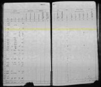 | 1885 Kansas State Census Record Sumner County, Caldwell
John Payne's farm's orchards:
175 apple trees
1 plum tree
2 cherry trees
1 dog |
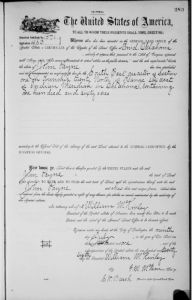 | 1901 Land Patent Oklahoma, Garfield County, Enid
John Payne's land patent cert #1571 in Enid, Garfield County, Oklahoma under President William McKinley July 9, 1901
Land Description: SE quarter of Section 1 in Township 29 North of Range 6 Wests of Indian Meridian in Oklahoma containing 160 acres
Found at: https://glorecords.blm.gov/details/patent/default.aspx?accession=OK0490__.283&docClass=STA&sid=rvbt1wvp.onf#patentDetailsTabIndex=1 |
|
|